1,488 geography tutors · rated 5/5
Private Geography Tutoring for Senior High: Grades 10, 11, 12 and the TKA
Geography changes shape partway through senior high. Grade 10 students meet it as one strand of Social Studies, and from grade 11 it turns into an elective that can also be carried into the TKA. A geography tutor meets the student wherever they are on that path, online or in person, from Rp 79.000 per hour.
1,488+
tutors
10,910+
students
5
rating · 3,272 reviews
60+
cities
What is Senior high geography tutoring?
Senior high geography tutoring is one-to-one support for the Indonesian Geography syllabus from grade 10 to grade 12: the geosphere, maps, remote sensing, GIS, Indonesia's strategic position, population, climate change, spatial planning and geopolitics. Students choose 60, 90 or 120 minute lessons, online or face to face, with fees from Rp 79.000 per hour.
- Grade 10: geography is taught within Social Studies, either integrated or as its own block, depending on the school
- Grades 11 and 12: Geography is an elective subject with 5 lesson periods a week
- Geography can be one of the two electives a student sits at the senior high TKA
- The tutor follows the chapter order and learning sequence of the student's own school
Services
Ways to Learn Geography with a Tutor
Choose the format that suits the student's schedule and learning style. For the same session length, online and in-person lessons cost the same.
Online Geography Lessons
Sessions on Zoom or Google Meet for students anywhere in Indonesia or abroad. Maps and imagery are opened together through screen sharing.
Rp 98.000/ 60-minute session
Price on the 28-session monthly plan, 60-minute sessions. Fewer meetings, higher price per session.
- Digital whiteboard for sketch maps and diagrams
- Session recordings to replay later
- Chat support between sessions
- Scheduling that fits the student's time zone
In-Person Geography Lessons
The tutor comes to the student's home. Works well for paper-based tasks such as cross-sections, map scale and concept maps.
Rp 124.000/ 90-minute session
Price on the 28-session monthly plan, 90-minute sessions. Fewer meetings, higher price per session.
- One tutor, one student
- Follows the school textbook and assignments
- Practice with essay questions and case studies
- Weekly progress notes over WhatsApp
Small-Group Geography
Two to four students learn together, for example classmates who all chose Geography. The fee is charged per person.
Rp 93.000/ 90-minute session
Price on the 28-session monthly plan, 90-minute sessions. Fewer meetings, higher price per session.
- Suits group projects built on geospatial data
- Shared discussion of regional case studies
- Lower per-person fee than a private session
- Schedule agreed by the whole group
Online and in-person cost the same — the gap between these cards is session length, nothing else.
What a Geography Tutor Covers, Grade by Grade
The chapters and their order follow the Geography learning outcomes set in BSKAP decree 046/H/KR/2025, together with the official grade 10, 11 and 12 textbooks.
Schools set their own learning sequence, so chapter order can differ from one school to the next. The first session starts by checking which chapter the student's class is on right now.
Grade 10 · Introduction to Geography
The geography strand of grade 10 Social Studies. Students meet the subject's objects of study, concepts, principles and three approaches, then start working with maps, satellite imagery and GIS.
- Objects of study, aspects and concepts
- Principles and approaches of geography
- Maps, remote sensing and GIS
- Steps in a geography research project
- +1 more
Grade 10 · The Geosphere in Indonesia
Earth's layers as living space: rocks and the forces that shape the surface, soil, air and water. This is where students meet the most terms and the most interlinked processes.
- The lithosphere and its dynamics
- The pedosphere
- The atmosphere: layers, weather and climate
- The hydrosphere
Grade 11 · Strategic Position and Biodiversity
Chapters I and II of the grade 11 textbook. Indonesia's location is read three ways, then linked to its natural resources and to how plants and animals are distributed.
- Astronomical, geographical and geological location
- Natural resource potential
- Flora and fauna distribution in Indonesia and worldwide
- Distribution factors and conservation
Grade 11 · Population, Climate and Hazards
Chapters III and IV of grade 11: the environment as a sustainable habitat, population as human capital, climate change, and hazard mitigation and adaptation.
- A sustainable living environment
- Population as human resources
- Climate change and global warming
- Hazard mitigation and adaptation
Grade 12 · Regions and Spatial Planning
Chapter 1 of the grade 12 textbook looks at how regions are developed, how villages and cities interact, and how space is planned, all the way to its link with a population's happiness index.
- Regional development
- Rural and urban interaction
- Spatial planning
- The happiness index
Grade 12 · Development and International Cooperation
Chapters 2 and 3 of grade 12: development indicators, how Industry 4.0 and Society 5.0 reshape space, international cooperation, geopolitics and Indonesia's regional resilience.
- Development paradigms and indicators
- Industry 4.0 and Society 5.0
- Cooperation between countries
- Geopolitics and regional resilience
Who It Is For
Who Geography Tutoring Is For
What a geography student needs depends on their grade and the electives they chose.
Grade 10 students
Geography is still part of Social Studies, and some schools rotate it with History, Economics and Sociology. Tutoring helps the student settle the basics of concepts, maps and the geosphere before Phase F begins.
Recommended:
Introduction to geographyMaps, remote sensing, GISLithosphere and atmosphere
Grade 11 students who chose Geography
Choosing Geography in grade 11 brings five lesson periods of it every week. The pace is quick, and the chapters from strategic position to hazards build on one another.
Recommended:
Indonesia's strategic positionBiodiversityClimate change and mitigation
Grade 12 students and TKA candidates
Students can pick Geography as one of their TKA electives. Students taking it into the TKA can use sessions to review the test outline while finishing their grade 12 chapters.
Recommended:
Regions and the environmentHuman and environment interactionComplex multiple-choice practice
Students who switched to Geography
The curriculum allows a switch of elective as late as semester 2 of grade 11. A student who joins late has chapters to catch up on that the class has already covered.
Recommended:
Summaries of missed chaptersGrade 10 foundationsMore frequent sessions at the start
Where Geography Students Get Stuck
The Parts of Senior High Geography That Hold Students Back Most
Drawn from geography education research in Indonesian senior high classrooms, each paired with how a private geography tutor works through it.
Geographic principles and approaches feel abstract
Why it happens
A grade 10 study (Jambura Geo Education Journal, 2023) found 75% of students could not yet answer questions on the principles and approaches of geography. It pointed to abstract material and teaching resources with too little real context.
How we fix it
The tutor applies all three approaches, spatial, ecological and regional complex analysis, to one and the same area, so the student sees how they differ on a concrete case.
Atmospheric layers and climate types get mixed up
Why it happens
A 2025 study of grade 10 students recorded misconceptions in 52% of answers on atmospheric layers and 52% on climate classification.
How we fix it
Students redraw the layers in order with their features, then classify climate straight from temperature and rainfall tables, so the categories come out of real data.
Remote sensing and GIS lag behind map work
Why it happens
In one grade 10 class of 34 students, average scores on maps were higher than on remote sensing and GIS. Both topics ask for a different way of reading than an ordinary map.
How we fix it
Sessions focus on recognising objects in imagery by tone, shape and pattern, then building GIS data layers one at a time until overlay analysis makes sense.
Answers stop at memorised facts and skip "why here?"
Why it happens
The Geography learning outcomes are framed around what, when, where, how and why a phenomenon appears in one particular place. Essay questions and case studies test that last part.
How we fix it
Students practise writing cause-and-effect answers that name the location, the physical factors and the human factors in turn, and the tutor checks the reasoning.
Grade 12 chapters are dense with terms and indicators
Why it happens
Regional development, development indicators, the happiness index and geopolitics bring a wave of new vocabulary, while the grade 12 elective runs for roughly 32 weeks.
How we fix it
The tutor helps the student build a concept map for each chapter and practise reading indicator tables, so every term is anchored to an example in the data.
These figures come from small-sample studies at a handful of schools, so read them as patterns worth watching for in class.
Why Us
What Comes with Every EduPoint Geography Session
The support a geography student gets alongside each private lesson.
The app.edupoint.id learning app
Self-study material, session recordings and progress reports, all in one place for the student.
Weekly notes on WhatsApp
Each week brings a summary of the chapters covered and the geography topics that still need practice.
Tutor replacement guarantee
If the geography tutor isn't the right fit, the student can ask for a replacement. Fit usually becomes clear after three or four sessions.
Sessions from 06.00 to 23.00
Lessons can go before school, after extracurriculars, or in the evening.
Six SMA Geography Tutors from Geography and Geography Education Majors
Among the six are Geography Education graduates trained as teachers, along with others who went deeper into Environmental Geography and Geographic Information Systems. Their campuses range from Banda Aceh, Jakarta, Bandung, and Yogyakarta to Makassar, while every card lists the university and field of study exactly as their EduPoint education history shows. When signing up, the learner just tells us which chapter is running at school, for instance the lithosphere or spatial planning, plus their open hours, and the EduPoint team picks the tutor closest to that need.
Tutor Qualifications
- Studied geography, geography education, or geographic information systems at university
- Understands how Geography differs as part of grade 10 social studies and as an elective in grades 11 to 12
- Used to reading maps, remote sensing imagery, and population data together with the learner
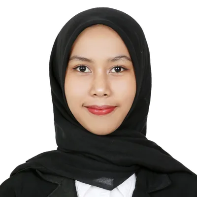
Ajeng A.
Environmental Geography, Universitas Gadjah Mada
The environment chapter through cases near home“Sustainable environment in grade 11 is easiest to grasp through places the learner already knows, such as a river near home or the city's landfill. Ajeng studied Environmental Geography at Universitas Gadjah Mada, and she uses examples like these to guide the learner through causes, impacts, and recovery efforts.”

Arif M.
Geography Education, Universitas Pendidikan Indonesia
Three geographic approaches through one event“The spatial, ecological, and regional complex approaches often sound alike in the grade 10 introductory chapter. Arif studied Geography Education at Universitas Pendidikan Indonesia, a program that prepares geography teachers, and he takes one event, for example a landslide on a hillside, and examines it from each angle in turn until the differences are clear.”
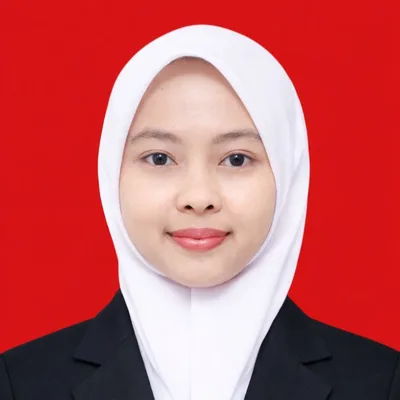
Cika C.
Geography Education, Universitas Muhammadiyah Prof. Dr. Hamka
Atmospheric layers and weather elements in one chart“The atmosphere brings many terms at once: troposphere, stratosphere, temperature, pressure, wind, and climate types. Cika, a Geography Education graduate of Universitas Muhammadiyah Prof. Dr. Hamka, has the learner build a chart of the air layers from the ground upward, then links each weather element to daily data that can be checked in the BMKG forecast.”

Taufan M.
Geography Education, Universitas Negeri Makassar and Universitas Negeri Malang
Endogenic and exogenic forces in Indonesia's landscape“Indonesia's mountain ranges, volcanoes, and fault valleys are endogenic forces that can be traced on a map. Taufan studied Geography Education at Universitas Negeri Makassar and Universitas Negeri Malang, and in the lithosphere chapter he first locates the tectonic plates on a map of Indonesia, then moves on to the weathering and erosion that shape its surface.”

Rena R.
Geography Education, Universitas Syiah Kuala
Disaster mitigation in order, from before to after“Disaster material appears in grade 10 and returns in grade 11 with deeper demands. Rena studied Geography Education at Universitas Syiah Kuala in Banda Aceh, and she trains the learner to sort mitigation steps into before, during, and after stages for earthquakes, tsunamis, landslides, and volcanic eruptions.”
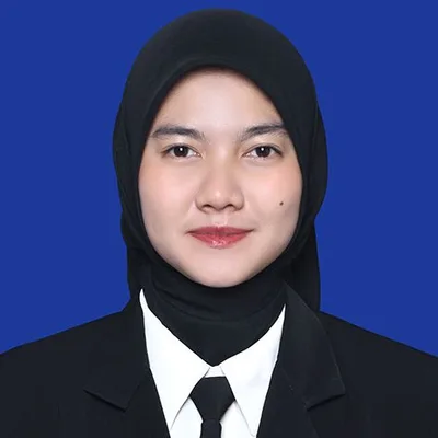
Alya A.
Geographic Information Systems, Universitas Gadjah Mada
Map and GIS projects from open data“Geography project assignments often ask for a thematic map or simple spatial data processing. Drawing on her Geographic Information Systems studies at Universitas Gadjah Mada, Alya helps the learner pick suitable open data, arrange layers in a free GIS application, and complete the map with a title, legend, scale, and north arrow.”
Geography Tutoring Fees
Private geography tutoring for senior high starts at Rp 79.000 per hour. Sessions last 60, 90 or 120 minutes, and group sessions lower the cost per person.
Starting from
Rp 79.000 / hour
Final price is set at registration.
This is the lowest hourly rate, derived from the 28-session monthly plan at 120 minutes per session. Per-session prices (60, 90, or 120 minutes) appear in the format options above.
Register & Get a QuoteFlexible payment — QRIS, Virtual Account, Alfamart, Indomaret, transfer & e-wallets.
Geography lesson fees can be settled through whichever channel suits the learner: Indomaret, Alfamart, a debit or credit card, an e-wallet, QRIS, a Virtual Account, or a regular bank transfer.
FAQ
Questions About Senior High Geography Tutoring
Quick answers to what senior high students ask most about a private geography tutor.
Fees for senior high geography tutoring start at Rp 79.000 per hour. A geography learner picks a 60, 90 or 120 minute session, and each of those durations is priced the same online and in person. In a small group of two to four, each student pays their own share, which works out lighter than a private lesson.
Yes. Each school arranges grade 10 Social Studies its own way: merged into one subject, rotated in blocks, or split into separate periods. The tutor adapts to the student's school and concentrates on the geography strand: the introduction to geography, maps, remote sensing, GIS and the geosphere.
Yes. A change of elective is still allowed as late as semester 2 of grade 11. The tutor usually starts with the chapters the class has already covered, such as Indonesia's strategic position and biodiversity, then moves on to the current chapter.
Yes. Geography is available as a senior high TKA elective, and in 2026 the exam runs from 26 October through 8 November. The published outline covers regions and the environment, physical and social processes, hazard mitigation, and human and environment interaction. Sessions review those areas alongside practice questions.
There is no Geography subject test in the UTBK-SNBT. The 2026 test is made up of the Scholastic Potential Test and the Literacy Test, with no split by subject group. Students preparing for UTBK can raise it during the consultation so the team can look for a suitable tutor.
Complete Guide
A Complete Guide to Senior High Geography Tutoring: Topic Flow, Practice, Assessment and TKA
Senior high Geography is built in layers, and the chapters in the upper grades keep drawing on what students picked up earlier. In grade 10, geography sits inside Social Studies alongside Sociology, Economics and History. It covers the basic concepts of geography, the lithosphere, atmosphere and hydrosphere as living space, and a first look at maps, remote sensing and geographic information systems (GIS). Each school decides how to arrange it, whether merged into one integrated Social Studies class, rotated block by block with the other three social sciences, or given periods of its own, so the amount of geography a grade 10 student actually gets can vary a lot between schools.
From grade 11, Geography becomes one of the electives, with 5 lesson periods a week, studied by students who choose it at schools that offer it. Grade 11 looks at Indonesia's strategic position from its astronomical, geographical and geological location, then biodiversity, environment and population, and finally climate change and disasters. Grade 12 moves on to regional development and spatial planning, development indicators, and international cooperation and geopolitics.
The links between grades are easy to trace. Indonesia's geological setting in grade 11 makes far more sense once the forces that shape the earth's surface, from the grade 10 lithosphere chapter, have sunk in. The disaster mitigation chapter calls on the atmosphere and the lithosphere at the same time. Spatial planning in grade 12 leans heavily on reading maps and GIS data layers. That is why private geography tutoring often starts by checking the grade 10 foundations before moving to the current chapter, especially for a student who finds the new material hard to connect with what came before.
Geography studies things students see around them every day, so practice material is easy to find. The Geography learning outcomes are framed around a set of questions: what, when, where, how, and why a phenomenon appears in a particular place. That set works well as a daily exercise. Pick one news story about the weather, population density or a new road, then answer all five questions in a single written paragraph.
For chapters packed with terms, redrawing things from memory helps them stay. A student can sketch the layers of the atmosphere with the features of each one without opening the book, then check against it. Climate classification is easier to remember when the student works it out from a table of monthly temperature and rainfall. Map skills can be practised by drawing a sketch map of the neighbourhood, complete with a compass rose, legend and scale, then measuring the distance between two points using that scale.
The process skills in the curriculum can also be built up at home: observing, asking questions, collecting data, grouping it, analysing it, then presenting it as a map, chart, table or infographic. One small topic, such as the population of each district in the student's own city, is enough to run through the whole sequence. The result can come along to the next geography lesson so the tutor can look at how the student reads and presents data. Short, regular practice, say twenty minutes a few times a week, is also much easier to keep up across a semester.
Geography at school is usually assessed at the end of each chapter, along with assignments and projects. The grade 12 Geography textbook, for example, closes every chapter with an assessment section. These questions often ask students to explain cause and effect, so an answer made up of definitions alone tends to fall short on essay and case-study questions.
Well-organised answers can be practised with a three-step pattern: name the location, explain the physical factors, then explain the human factors. For questions on the approaches to geography, a student can practise applying spatial analysis, ecological analysis and regional complex analysis to the same area, which makes the difference between the three visible in a single case. For grade 12 questions on development indicators or the happiness index, practice reading tables and charts ties the terms to actual numbers.
The Phase F curriculum also asks for collaborative projects on geographic phenomena in Indonesia or around the world using geospatial technology, with results shared through maps, charts, infographics or digital apps. One aim of the subject is understanding disaster mitigation and adaptation in the student's own surroundings and at the national level, so that theme often shows up in projects. In private geography tutoring, the tutor helps the student break a project into data collection, processing and presentation, then checks whether the conclusions follow from the data. The project remains the work of the student and their group, with the tutor guiding the steps and giving feedback.
Students who have taken Geography since grade 11 can put it into the senior high TKA. Every candidate writes Indonesian, Mathematics and English, then adds two electives of their own, and Geography is among the options. In 2026 the exam window stretches from 26 October to 8 November and is split into two waves, 26 to 29 October for the first and 2 to 5 November for the second. Candidates write one subject a day over four days, with both electives falling on the last day. Results are scheduled for release on 23 December 2026.
The summary of the Geography TKA outline covers regions and the environment, physical and social processes, disaster mitigation, and the interaction between people and nature. Those areas map onto school chapters. Physical processes rest on the grade 10 geosphere chapters. Disaster mitigation lives in the grade 11 chapter on climate change and disasters. Human and nature interaction ties in with the chapter on strategic position and natural resources, while regions and the environment touch on population and spatial planning.
The TKA falls while grade 12 chapters are still running, so geography sessions can be split in two: part for the chapter currently taught in class, part for reviewing the outline areas from grades 10 and 11 with practice questions. Exam details can be updated, so students should confirm the latest schedule and rules with their school or the official announcements. Tutoring helps a student practise and spot the chapters that still need work, and the TKA score itself is decided by the exam.
What the student brings to a geography lesson decides how quickly the tutor can find the knot: the chapter currently running in class, an unfinished assignment or project, and marked test papers. From those, the tutor can see exactly where understanding stops. A student might know the names of the atmospheric layers yet struggle to explain how weather forms, or read maps comfortably yet find it hard to identify features on a remote sensing image.
Geography education research in grade 10 classrooms points to a few areas where students often get held up: the principles and approaches of geography, atmospheric layers and climate classification, and remote sensing and GIS. A student who feels stuck in the same places can mention it during the consultation, so the first sessions go straight there.
The process is simple. The student, or whoever is enrolling them, starts with a consultation, and the team notes the schedule, grade, school curriculum and the chapters to work on. Working from those notes, the team looks for a geography tutor suited to the student, and lessons begin as soon as a timetable is settled. A geography lesson runs for 60, 90 or 120 minutes, can start any time from 06.00 up to 23.00 so it fits after school or on weekends, and takes place on Zoom, Google Meet or face to face. Online sessions are recorded, so the steps for reading an image or stacking data layers can be replayed later. Every week the student receives progress notes on WhatsApp, and self-study material and progress reports are available at app.edupoint.id. Should the match feel off after a few sessions, the student is free to request a different tutor.
Guides & Tips
Supporting articles to help you decide and maximize learning outcomes.
How to Learn Geography with Maps and Spatial Concepts
Geography feels light when every topic starts from a map, then each fact is tied to its location through spatial concepts until the map tells its own story.
How to Read Latitude and Longitude Coordinates for Beginners
A step by step guide to reading geographic coordinates, from the equator to a point in a map app.
How to Read Maps and Atlases for Students
A step-by-step guide to reading the map frame, decoding the legend, and locating places through the atlas index.
How to Understand Physical Geography for UTBK
A learning flow that links the lithosphere, atmosphere, and hydrosphere so TKA geography analysis questions feel clear.
Related Tutoring Programs
Senior high tutoring and other social science subjects students often pair with Geography.
Start Senior High Geography Tutoring
Tell us the student's grade, school and current geography chapter. The team notes the schedule, finds a geography tutor who fits, and lessons can begin.