Online Geography Tutoring
Online Geography Tutoring - Explore Maps & Earth Live from Home
Geography-major tutors guide your child through live one-on-one private sessions, opening the same maps, atlases, and satellite imagery on screen to understand the lithosphere, climate, population, and Geographic Information Systems. Schedules follow your family rhythm within 06.00 to 23.00, with no travel cost.

130+
tutors
720+
students
4.9
rating · 888 reviews
60+
cities
What is Online Geography Tutoring?
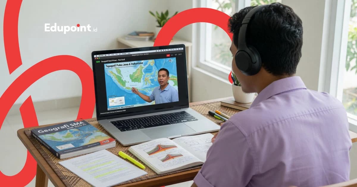
Online geography tutoring is private, one teacher one student guidance that runs live and remotely, with tutor and student opening the same maps, digital atlases, and satellite imagery on screen. The material spans the dynamics of the lithosphere, atmosphere, and hydrosphere, population distribution, map reading, and Geographic Information Systems. Geography asks a child to see places they cannot physically visit, and the screen brings any mountain, river, or ocean current right in front of their eyes.
- Live 1-on-1 sessions with tutors majoring in Geography Education from state universities
- Maps, digital atlases, and satellite imagery opened together on screen and dissected step by step
- Every session recorded and stored in the app to replay explanations of tricky concepts
- Guided map interpretation and university entrance exam practice
- Suitable for middle school, high school, and geography university students across Indonesia
Services
Two Tracks of Online Geography Tutoring
The same geography-major tutors support routine concept building and entrance-exam preparation, all delivered online
Routine Online Geography
Live private sessions for middle and high school students
Rp 97.000/ 90-minute session
Price on the 28-session monthly plan, 90-minute sessions. Fewer meetings, higher price per session.
- Learn live 1-on-1 with a geography-major tutor
- Maps and modules opened together on screen
- Recorded sessions to replay
- Flexible scheduling within 06.00 to 23.00
Online Entrance Exam Geography Intensive
Focused sessions for social-science geography questions
Rp 97.000/ 90-minute session
Price on the 28-session monthly plan, 90-minute sessions. Fewer meetings, higher price per session.
- Step-by-step discussion of entrance-exam geography questions
- Thematic map and regional analysis
- Focused answering-strategy practice
- Suitable for university hopefuls from any city
Online Geography Tutoring Levels
Online geography material adjusts to each stage, from the map of your surroundings to regional analysis for entrance exams and university
Elementary Geography
Grades 4-6Introduction to local maps, compass directions, and natural features through friendly, image-rich online sessions
Subjects:
Local MapsDirections and LayoutsNatural Features
Focus Areas:
- Reading simple maps together on screen
- Recognizing compass directions and layouts
- Observing mountains, rivers, and seas via imagery
- Growing curiosity about places
Middle School Geography
Social Studies, Grades 7-9Strengthening geography within social studies, from continents and climate to population, with a world map opened alongside the tutor
Subjects:
Continents and OceansClimate and WeatherPopulation Dynamics
Focus Areas:
- Understanding the position of continents and countries
- Telling weather apart from climate
- Reading population distribution maps
- Connecting nature with human life
High School & Entrance Exam Geography
Social Science Track, Grades 10-12Deepening specialized geography and entrance exam practice, from the lithosphere to Geographic Information Systems, through focused live sessions
Subjects:
Lithosphere & Disaster MitigationAtmosphere & HydrosphereGIS & Remote Sensing
Focus Areas:
- Analyzing endogenic forces and hazards
- Reading climate patterns and river flows
- Interpreting satellite imagery and thematic maps
- Guided entrance exam geography practice
University Geography & GIS
Students & EnthusiastsSupport for university geography courses and an introduction to Geographic Information Systems, with tutors who can share their screen for mapping software
Subjects:
Basic CartographyIntroduction to GISRegional Geography
Focus Areas:
- Understanding map projection and scale
- Getting to know QGIS via screen sharing
- Reading thematic maps and data overlays
- Analyzing regions and spatial planning
Online Geography Tutoring Curriculum
Built up in stages and opened together on screen, from reading maps to analyzing regions and hazards
Each module's weight adjusts to the level, from middle school social-studies geography to the high school specialization and an introduction to GIS, and everything is stored in the app to reopen before exams
Maps, Atlases & Remote Sensing
Reading and interpreting maps and satellite imagery before moving into deeper analysis
- Map elements and symbols
- Scale and projection
- Interpreting satellite imagery
- Reading thematic maps
Lithosphere & Disaster Mitigation
Understanding the forces that shape the earth's surface and preparedness for geological hazards
- Tectonics and earthquakes
- Volcanism and volcanoes
- Rock and soil types
- Regional disaster mitigation
Atmosphere & Climate Change
Recognizing weather and climate patterns and their link to global climate change
- Weather and climate elements
- Climate classification
- Wind and rainfall
- Climate change issues
Hydrosphere & Biosphere
Tracing the water cycle, river flows, and the distribution of flora and fauna across the earth
- The hydrological cycle
- Rivers and watersheds
- Marine waters
- Distribution of flora and fauna
Anthroposphere & Geographic Information Systems
Reading population dynamics and processing spatial data with an introduction to GIS
- Population pyramids and mobility
- Settlement patterns and regions
- Introduction to GIS and data overlays
- Simple spatial analysis
Who It Is For
Online Geography Tutoring for Every Learning Need
From a child just getting to know the map of their surroundings to an entrance-exam hopeful chasing a state university, every need can be supported online
Middle School Students
Students who want to strengthen geography within social studies, from continents and climate to population, from any city
Recommended:
Start with reading the world mapConnecting nature and people
High School Social-Science Students
Social-science track students deepening the lithosphere, climate, and GIS while preparing for school exams
Recommended:
Focus on lithosphere and hydrosphereIntroduction to Geographic Information Systems
Entrance Exam Hopefuls
Grade 12 students and alumni aiming for state universities who need focused social-science geography practice
Recommended:
Guided entrance-exam practiceRegional and thematic map analysis
Children in Areas with Limited Tutor Access
Families who want their child to learn geography with a major-relevant tutor rarely available in their city
Recommended:
Learn with a chosen tutorSchedule that follows the family
Featured
The EduPoint Learning System for Online Geography Tutoring
Every online geography lesson leans on one shared co-learning workspace, records itself automatically, and sends parents a progress summary so remote study stays visible
Report Features
Maps & Co-Learning Modules on Screen
Tutor and student open the same map and geography worksheet during the session, so the child follows each step of interpreting imagery and connecting concepts without falling behind.
Recorded Sessions to Replay
Every meeting is recorded and kept in the app, letting the child replay how a tectonic process unfolds or the steps of reading a thematic map whenever they need it.
Material You Can Reopen
Practice sheets, reference atlases, and geography notes stay in the EduPoint app, making it easy for the child to revisit climate or population material before an exam.
Progress Reported to Parents
Each geography theme's progress gets logged and distilled into a parent update, so the family sees where the child is already strong and which parts still need company.
Sample Progress Report
Fira (grade 11)
High School Grade 11 • Second month of support
75%
Overall Progress
Sessions Completed
8 of 12
Next Milestone
Simulation of entrance-exam style geography questions
Oct 1, 2001
Map Reading & Remote Sensing
On Track84/92
Already fluent at reading map symbols and interpreting simple satellite imagery
Lithosphere & Disaster Mitigation
Improving74/88
Tectonic concepts improving, still strengthening volcano eruption types
Population Dynamics
Needs Attention66/85
Reading population pyramids needs extra practice via recorded sessions
Common Remote-Learning Challenges
Three Challenges of Learning Geography Online and How We Handle Them
Learning geography remotely has its own challenges, and our online geography tutors are used to guiding children through them
Geography is mistaken for merely memorizing place names
Why it happens
Without a moving map, a child easily assumes geography is just a list of continents, rivers, and countries to remember.
How we fix it
The tutor opens a digital map and satellite imagery on screen, then invites the child to trace for themselves why mountains line up along certain paths and rivers flow in certain directions, so geography feels like the logic of place that can be understood.
Focus scatters with notifications and other screens
Why it happens
Learning from home makes distractions from devices and other tabs easy to steal attention during a session.
How we fix it
The session is broken into short rounds with one clear theme each, from reading maps to discussing questions, and recordings are available for anything missed, so the child can focus on one geographic phenomenon at a time.
Uncertainty about whether the material truly sinks in remotely
Why it happens
Without meeting in person, parents find it hard to judge how well the child grasps abstract concepts.
How we fix it
We track and summarize how the child is doing on every geography theme for parents, from clear strengths to spots that still need company, so their development stays visible even at a distance.
Learning geography online can run lively and stay monitored when the session is designed to let the child trace the map themselves, with their own hand moving the screen.
Why Us
Why Online Geography Tutoring at EduPoint Feels Alive
Geography easily feels like rote memorization when it is only read from a book, and this is where live sessions with maps moving on screen make the difference
Live Teacher, Not a Recorded Class
The child learns with a real tutor who answers questions on the spot, so confusion about geological processes or climate patterns is untangled right there in the session.
Maps and the Earth Move on Screen
The tutor invites the child to spin a digital map and trace satellite imagery directly, so geography feels like exploring places, and names stick because they are understood on the map.
Tutors Are Genuine Geography People
Our tutors come from Geography Education programs, understand the logic behind each earth phenomenon, and are used to explaining it in language a child can follow.
Focused for the Entrance Exam
Entrance-exam geography practice is worked through step by step on the on-screen module, from regional analysis to reading thematic maps, so the child's preparation is more measured.
Replay Anytime
Recordings and reference atlases stay in the app, making it easy for the child to revisit tough lithosphere or population themes before a test.
EduPoint Online Geography Tutors
Our tutors are students and alumni of Geography Education programs from the best state universities, used to reading maps, processing spatial data, and teaching live online
Tutor Qualifications
- Students and alumni of Geography Education programs at the best state universities
- Used to reading maps, atlases, and remote-sensing imagery
- Experienced in guiding students through university entrance exams online
- Teach the logic of place before memorization, with real maps on screen
Diana D.
Geography Education, Universitas Negeri Padang
Map reading made enjoyable“Diana opens the online session by inviting the student to spin a digital map together, tracing landforms until the child can read symbols and scale before moving into concepts.”
Selvi S.
Geography Education, Universitas Negeri Jakarta
Lithosphere and disaster mitigation“Selvi explains tectonic processes and volcanoes through on-screen animation and satellite imagery, so students understand why disasters happen and how a region prepares.”
Karysa K.
Geography Education, Universitas Negeri Yogyakarta
Climate and the atmosphere“Karysa guides students to read weather and climate patterns on a shared map, until the difference between weather and climate is understood without raw memorization.”
Rahma R.
Geography Education, Universitas Pendidikan Indonesia
Geography for entrance exams“Rahma is used to dissecting entrance-exam geography questions live, guiding students to analyze regions on the map step by step so the answering strategy takes hold.”

Rina R.
Geography Education, Universitas Negeri Medan
Hydrosphere and biosphere“Rina teaches the water cycle and the distribution of flora and fauna with examples from the student's own region, so hydrosphere material feels close even in an online session.”
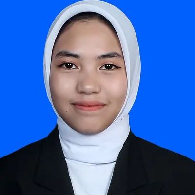
Ros R.
Geography Education, Universitas Negeri Makassar
Population and introduction to GIS“Ros guides students to read population pyramids and get to know thematic maps via screen sharing, showing how spatial data tells the story of human life.”
Testimonials
Stories from Families Who Tried Online Geography Tutoring
My child in Ternate struggled to find a specialized geography teacher. Through online tutoring with Ms. Selvi, she learns from home and started to grasp lithosphere material. She often replays the recordings before a test.
Mrs. Wulan H.
Parent of a High School Student • Ternate
I was chasing the social-science entrance exam and geography was my weak spot. Ms. Rahma discussed regional questions on the map on screen until I knew the strategy. Because it is online, I could join without leaving home.
Bintang P.
Grade 12 Student • Palangkaraya
My middle schooler thought geography was just memorizing country names. Ms. Karysa took him exploring the world map through the screen, and now he actually enjoys learning about climate and continents.
Mrs. Ratih S.
Parent of a Middle School Student • Jember
In our city, teachers who understand GIS are rare. Through screen sharing, Ms. Ros showed how to read thematic maps and introduced GIS basics to my child who studies geography at university.
Mr. Hendra W.
Parent of a University Student • Kupang
My schedule is packed with school activities. Online geography tutoring can be arranged in the evening, and Ms. Rina explained the hydrosphere using rivers from my own area. The material felt more real.
Ayu N.
High School Student • Banjarmasin
Online Geography Tutoring Cost
A measured hourly rate for live sessions with geography-major tutors
Starting from
Rp 61.000 / hour
Final price is set at registration.
This is the lowest hourly rate, derived from the 28-session monthly plan at 120 minutes per session. Per-session prices (60, 90, or 120 minutes) appear in the format options above.
Flexible payment — QRIS, Virtual Account, Alfamart, Indomaret, transfer & e-wallets.
Learning online removes travel costs, so the family budget is lighter and can be focused on the number of sessions truly needed. The intensive package ahead of the entrance exam can be adjusted to the exam timeline.
Online Geography Tutoring Availability
Online Tutoring
Online WorldwideOnline geography tutoring via Zoom or Google Meet is available for students across Indonesia and abroad, with no distance limit
Student Achievements
Stories of Online Geography Students
Real achievements from EduPoint students
Success
From a Small City, Heading to the Entrance Exam with a Map in Hand
Bintang (grade 12)
High School in Palangkaraya
Before
55
After
88
+33 point score gain
4 months of online tutoring
Accepted at
Confident toward the entrance exam
“In my city it was hard to find a geography teacher. Online tutoring let me learn from home, and the question discussion on the map on screen was something I often replayed before a mock test.”
Tutors:
Ms. Rahma R. (Entrance Exam Geography)
Success
Geography Stopped Feeling Like Memorization
Fira (grade 11)
High School in Banjarmasin
Before
60
After
86
+26 point understanding gain
3 months of online tutoring
Accepted at
Specialization scores improved
“I used to think geography was just memorizing. After tracing maps together with the tutor online, I came to understand why mountains and rivers sit where they do.”
Tutors:
Ms. Selvi S. (Lithosphere)
FAQ
Before You Start Online Geography Tutoring
Guides & Tips
Supporting articles to help you decide and maximize learning outcomes.
How to Learn Geography with Maps and Spatial Concepts
Geography feels light when every topic starts from a map, then each fact is tied to its location through spatial concepts until the map tells its own story.
How to Read Latitude and Longitude Coordinates for Beginners
A step by step guide to reading geographic coordinates, from the equator to a point in a map app.
How to Read Maps and Atlases for Students
A step-by-step guide to reading the map frame, decoding the legend, and locating places through the atlas index.
How to Understand Physical Geography for UTBK
A learning flow that links the lithosphere, atmosphere, and hydrosphere so TKA geography analysis questions feel clear.
Related Programs
Other programs that might be suitable for you
Start Online Geography Tutoring from Home
Kick off with a free consultation to map out your child's needs alongside a geography-major tutor, then dive into live private sessions that trace maps with no distance standing in the way